SP1: Noise maps & modelling
Considerations
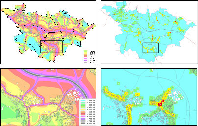
- Update of the existing available noise maps for the following cities (or part of it): Antwerp (B), Athens (G), Brussels (B), Caen (F), Göteborg (S), Augsburg (D), Ostend (B), Stockholm (S), Stuttgart (D).
- Identification of hotspots and quiet areas on the above mentioned noise maps.
- The sensitivity of the calculations in regards to traffic data and selected receptor points will be investigated.
- Relevant figures on noise annoyance and sleep disturbance as well as their monetary effect will also be linked to the noise maps.
- The noise maps will later be recalculated with the inclusion of the proposed mitigation measures.
- Software compatible with the EU-Directive will be used. No new software development is required.
Workpackage 1: Noise maps - initial situations
- Automated hot-spot detection from noise maps with noise environment rating model.
- Noise Mapping of the selected cities. Preliminary discussions on possible mitigation actions. Analysis of hot spots with respect to the city's noise score rating model.
- Linking outcomes of detailed mitigation studies in which dedicated specific noise calculation tools are used, to the global noise maps.
- Intermediate evaluation of benefits from mitigation measures
Workpackage 2: Noise maps – after integrating action plan measures
- How to produce relevant figures on noise annoyance, sleep disturbance, and monetary valuation on the basis of noise maps, using the Position Papers of WG2 / WG HSEA, which have been founded by EU/DG Env on these subjects.
- Linking in more detail outcomes of elaborated mitigation studies in which dedicated specific noise calculation tools are used, to the global noise maps.
- Final evaluation of benefits from mitigation measures as proposed for the prototypical situation by recalculating noise maps after incorporating mitigation measures.